Save lives by uncovering hidden data in your city


Pedestrian fatalities have increased 19% in just 3 years (https://www.ghsa.org/resources/Pedestrians23), yet local traffic engineers have few tools, other than expensive and slow-to-build street reconfigurations, to address this disturbing trend. Metrolla’s tools give traffic engineers an affordable, easy to implement way to make intersections safer.

The last thing anyone wants to find out is that your new pedestrian or bike amenities are actually increasing the risks of vehicle/pedestrian collisions! Kirkland wanted to determine whether a new multi-use path (created from a former rail line) was increasing jaywalking and associated near-miss pedestrian risks
The new Eastrail multi-use path meets major streets mid-block. Kirkland Washington’s transportation department was getting reports of increased jaywalking activity, and worked with Metrolla to understand whether that was true, and if so what patterns could be detected.
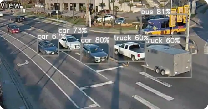
The City of Bellevue wanted to analyze detailed traffic information about a key problem intersection to protect pedestrians and cyclists. Metrolla installed hardware that processed existing camera data, and developed a proprietary algorithm for the location. The work allowed the city to gain visibility on erratic-driving based near-miss detection at a key intersection. Developed in partnership with T-mobile.
“We have zero visibility into our city. We don’t understand traffic or pedestrian patterns, we only know we have recurring issues at these locations.” Metrolla helps you understand and plan to resolve traffic safety challenges.

Please share your details with us so we can best assist you.
Alternatively if you are in a rush you can find time to meet with us here
