
The world of technology is advancing at a rapid pace, and sensors like LiDAR and RADAR are playing crucial roles in revolutionizing industries like autonomous vehicles, smart cities, industrial automation, and even space exploration. Both of these sensing technologies are vital for perceiving environments, enabling machines to understand the physical world and make intelligent decisions. While LiDAR and RADAR are often mentioned together, they are fundamentally different in how they operate and the data they provide.
In this article, we’ll explore the core differences between LiDAR (Light Detection and Ranging) and RADAR (Radio Detection and Ranging), their strengths, weaknesses, and their applications across various sectors. By the end, you’ll have a clear understanding of how these two sensing technologies stack up and which scenarios each one excels in.
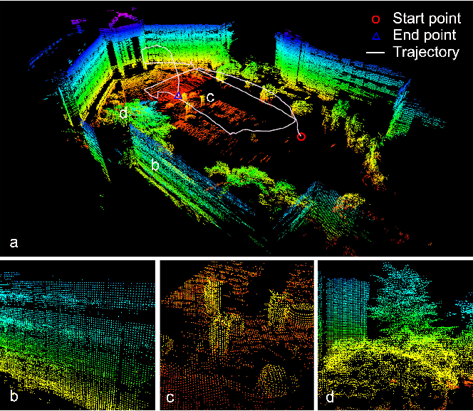
LiDAR (Light Detection and Ranging) is a remote sensing technology that uses laser beams to measure distances. By emitting pulses of laser light, LiDAR sensors detect objects in the surrounding environment and calculate the time it takes for the light to bounce back to the sensor. This time-of-flight data allows the sensor to build detailed, 3D maps of an environment in real-time.
LiDAR systems consist of three key components:
When a LiDAR sensor emits laser pulses, the light reflects off objects, such as buildings, trees, or vehicles, and returns to the sensor. The sensor then calculates the distance to the object by using the speed of light and the time it took for the pulse to return. This process happens rapidly, thousands of times per second, enabling the creation of a high-resolution, 3D map of the environment.
RADAR (Radio Detection and Ranging) is a sensing technology that uses radio waves to detect the range, speed, and angle of objects. RADAR emits radio waves, which bounce off objects and return to the sensor. The time delay between emission and return is used to calculate the distance to the object, while the Doppler effect is used to measure the object's velocity.
RADAR works by sending out radio frequency waves in the electromagnetic spectrum. When these waves hit an object, they reflect back toward the RADAR sensor. Based on the time it takes for the wave to return, the system calculates the distance to the object. In addition to measuring distance, RADAR can also detect the speed of moving objects through the Doppler shift—the change in frequency or wavelength of a wave in relation to an observer moving relative to the source.
Now that we have a basic understanding of how LiDAR and RADAR work, let’s break down the key differences between the two technologies in several critical areas.
While autonomous vehicles are often associated with both LiDAR and RADAR technologies, the roles they play are different. LiDAR is frequently used for environmental mapping and object detection, helping the vehicle “see” its surroundings with high precision. On the other hand, RADAR is employed to detect the speed and location of moving objects, such as other cars, and to ensure safe driving in various weather conditions. Together, they provide the redundancy and data required for autonomous driving.
LiDAR is often used in urban planning, providing detailed 3D maps of cities, roads, and buildings. It’s also widely used in the development of smart city technologies, where accurate mapping is essential for managing traffic flows, infrastructure, and even emergency response. RADAR, on the other hand, is more commonly applied in traffic monitoring and speed enforcement due to its ability to track moving objects and vehicles over long distances.
In industrial settings, LiDAR is used for robot navigation, where precision is critical for avoiding obstacles and interacting with objects. RADAR is typically used in applications that require monitoring movement over larger distances, such as crane operations or monitoring the location of vehicles and equipment in large industrial yards.
RADAR has been a staple in aerospace and defense for decades, used for tracking aircraft, monitoring weather patterns, and guiding missiles. Its long-range detection capabilities and all-weather performance make it ideal for these applications. LiDAR, meanwhile, is starting to make inroads into aerospace for terrain mapping and navigation in low-Earth orbit, but it’s not yet as ubiquitous as RADAR.
LiDAR excels in environmental monitoring, particularly in areas like forest management and coastal erosion, where detailed terrain mapping is essential. RADAR is commonly used in weather monitoring, where it helps track precipitation, storms, and wind patterns. The combination of both technologies is often used to gain a more comprehensive view of the environment.
As both LiDAR and RADAR continue to evolve, their applications are expanding rapidly across industries. LiDAR is becoming more compact and affordable, making it more accessible for widespread use, particularly in autonomous vehicles, industrial automation, and smart city applications. Solid-state LiDAR is one of the most promising developments in this space, as it offers reduced costs and improved durability compared to traditional mechanical LiDAR systems.
RADAR, too, is advancing, with innovations such as millimeter-wave RADAR improving resolution and reducing the size of sensors. This development could lead to RADAR being used in applications where LiDAR currently dominates, such as in high-resolution mapping.
In the future, the combination of LiDAR, RADAR, and other sensors like cameras will likely become the norm in many industries, providing redundancy and a more comprehensive understanding of the environment.
Both LiDAR and RADAR are critical technologies with unique strengths and limitations. LiDAR’s strength lies in its high-resolution, 3D mapping capabilities, making it ideal for applications that require precision and detail. RADAR, on the other hand, offers long-range detection and weather resilience, making it indispensable for tracking moving objects and operating in challenging environments.
Choosing between LiDAR and RADAR often comes down to the specific needs of the application. In some cases, combining both technologies may provide the most reliable solution, offering a balance of precision, range, and durability.
As the demand for autonomous systems, smart infrastructure, and advanced industrial automation continues to grow, understanding the differences between these technologies will be essential in making informed decisions about their use.